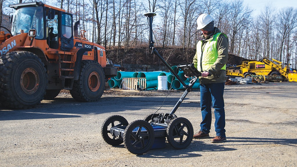
Excavation contractors can reduce risk with in-house ground penetrating radar operation

Excavation crews in the field face a variety of complex challenges before they dig. These are magnified when considering other major factors like project timelines, budget constraints, and the quality of existing utility maps and other subsurface data for specific jobsites. They also have to work in a diverse range of landscapes and soil conditions.
Preventing damage to underground utilities and locating other underground obstacles should remain a consistent goal for excavation contractors. The best way to accomplish this is by collecting data on the subsurface field conditions of each jobsite before breaking ground.
To best mitigate damage risks and collect necessary data simultaneously, many excavation contractors are deploying advanced ground penetrating radar (GPR) systems. When implementing the technology in-house, GPR creates an instant, data-driven deliverable that can be put to immediate use in the field.
Here are just some of the ways that excavation contractors can benefit from deploying GPR on their next project.
The second opinion after the one-call
A one-call must be placed at least five business days prior to digging; information on regulations and the one-call service for each province can be found at
digsafecanada.ca. (Excavation contractors in the U.S. should visit call811.com/Before-You-Dig for information on state regulations and 811 call services.) The one-call is a necessary and valuable initial survey of the dig site. However, once the locators have finished their assignments, the colour-coded flags and paint marks only tell part of the story. Here are some important factors to keep in mind:
First, one-call locators are only obligated to locate public utilities within the boundaries of the dig site. They are not responsible for private facilities or non-utility objects beneath the surface.
This offers a partial view of the conditions below but does not guarantee absolute risk mitigation.
Second, the one-call service providers suit their equipment arsenal to find the specific utilities they are assigned to locate. Common tools like electromagnetic locators, for example, are designed to identify metallic and conductive objects. Instead of providing a complete view of the subsurface field conditions, these tools are intended to find key touchpoints.
Advanced GPR systems are designed to image the entire subsurface with greater depth and clarity than traditional counterparts. Using the system controller, the operator can view prevailing field conditions in real-time, confirm one-call findings, and expand upon them by also surveying for private facilities, boulders, tanks, changes in soil structure, and other targets of interest that may otherwise go unnoticed.
GPR data not only confirms and expands upon one-call findings, but it also provides the contractors with the confidence to start a project with peace of mind and the ability to modify project strategies should any obstacles arise. The crew in the field can also begin working with greater efficiency and assurance knowing measures have been taken to mitigate common damage risks prior to breaking ground.
Overcoming unforgiving soil
North America's diverse landscape creates a variety of environmental and operational challenges for locators. Someone working in the plains will have a different set of parameters from someone locating at a seaside beach resort. For contractors that operate across multiple locations and situations, soil conditions can change on a day-to-day basis depending on the jobsite.
The composition of the soil and surface terrain conditions can impede some locating equipment from creating usable data. Rough terrain and lossy soil will negatively affect signal penetration, especially for higher-frequency signals.
Conversely, dry, sandy soil will allow signals to travel at greater depths with far less resistance and signal loss. Someone using an EM locator over wet clay will find the signal dissipating quickly, if it even registers at all.
When selecting a GPR system for in-house field use, it's important to consider a system that has both the hardware and antenna capabilities to traverse multiple terrains without breaking down or losing signal. Look for a unit with a tough construction and airless tires, so that the system can endure long stretches of use.
If you are operating in lossy soil, consider using a triple-frequency system as well. These systems will collect data across low-, middle- and high-centre frequency ranges simultaneously. This not only compensates for unforgiving soil, but it allows the operator to cross-compare multiple datasets for an even clearer understanding of prevailing subsurface conditions.
Creating a deliverable for the future
GPR's greatest advantage to crews in the field is its ability to generate instant deliverables that can be immediately implemented. A high-end GPR system should also enable the user to store, share, and post-process the data directly from the controller console.
These deliverables create a common point of reference for future installation and maintenance projects at the same site. Though GPR already proves a time-effective damage prevention solution, that time is reduced even further with existing data in hand. This enables the crew in the field to begin followup assignments with much shorter preparation requirements.
When considering a GPR system, be sure to look for post-processing features like 3D imaging, GPS integration, and mapping software that can enable the user to create dynamic visual models of the raw data. This will translate key information into easily understandable models that decision-makers can use for future reference or to strategize in the present.
Ray Cummins is a field application specialist for US Radar, Inc.


