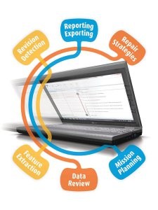
WinCan GIS makes it easy to manage water, stormwater and sewer infrastructure using GIS data. Users can click-and-drag or query a map to create entire WinCan projects with prepopulated section data; automatically create linked map elements from observations; dispatch inspection and rehab crews with unprecedented ease; and augment GIS data with more infrastructure detail.
Among other functionality, WinCan GIS supports: feature extraction – plot observations into your GIS as point features with links to videos and photos; revision detection – highlight differences between GIS and WinCan data; reporting/exporting – create reports and export data into Excel; repair strategies – utilize observation data to create pipe-specific repair strategies; data review: review WinCan data outside of WinCan; mission planning – use GIS to create subsets of data for pipes to be inspected.


