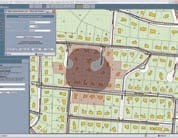
VUEWorks is a GIS map tool that is designed around industry-specific technology allowing it to process data that can be used to display maps of projects, link with customer calls, generate work orders, plan capital spending, and engage in many other aspects of government operations. VUEWorks provides an easy interface for users of all levels to access the stored data. They can then use the data to do a wide range of projects: view maps to plan projects or plot out service calls, create lists of located features in specific areas, look over specific properties, and many more necessary tasks.


